Discover the Heart of Africa! From sweeping savannas and deserts to forests, mountains, and mighty rivers, Africa is home to an incredible variety of landscapes — and an equally incredible variety of wildlife. Travel across the continent with Chester Zoo to explore some of its most fascinating habitats and discover how geography shapes the animals and people who live there.
Explore the countries and landscapes that make up Africa, identify different habitats, and see what makes each one unique. Then zoom in on the savanna to investigate its climate and discover what life is like in one of the world's most iconic ecosystems.
But the savanna is changing. Learn how shifts in climate are affecting this landscape and the wildlife that depends on it, and discover ways people can help protect these important habitats. Along the way, you'll build your geography skills while seeing Africa — and its wildlife — in a whole new way
Don't miss the geography worksheets that go with this lesson!
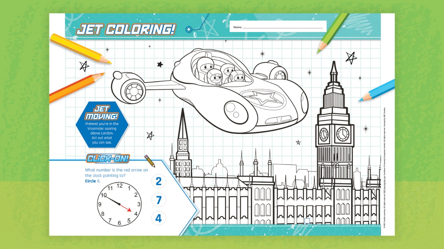
Flying over London in a jet? What a view! Can you figure out what time Big Ben is showing? Pretend you’re in the Vroomster soaring above London. Act out what you can see.
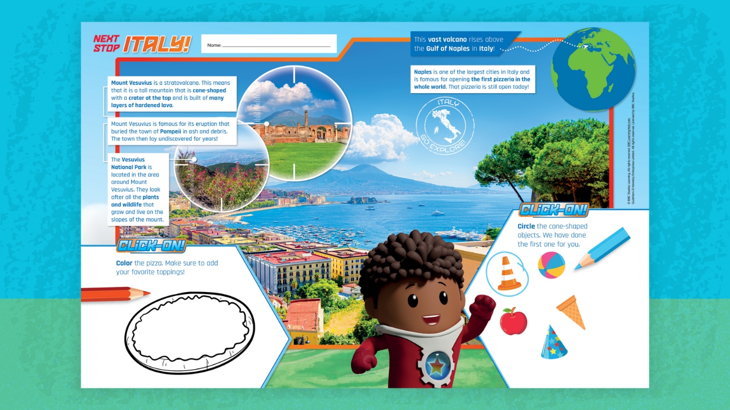
Discover Italy’s natural wonders and cultural treasures! In this fun worksheet, you'll:
- Learn what makes a stratovolcano, why Mount Vesuvius is famous, and how Naples shaped pizza history.
- Locate Italy on a map.
- Color a pizza.
- Identify shapes.
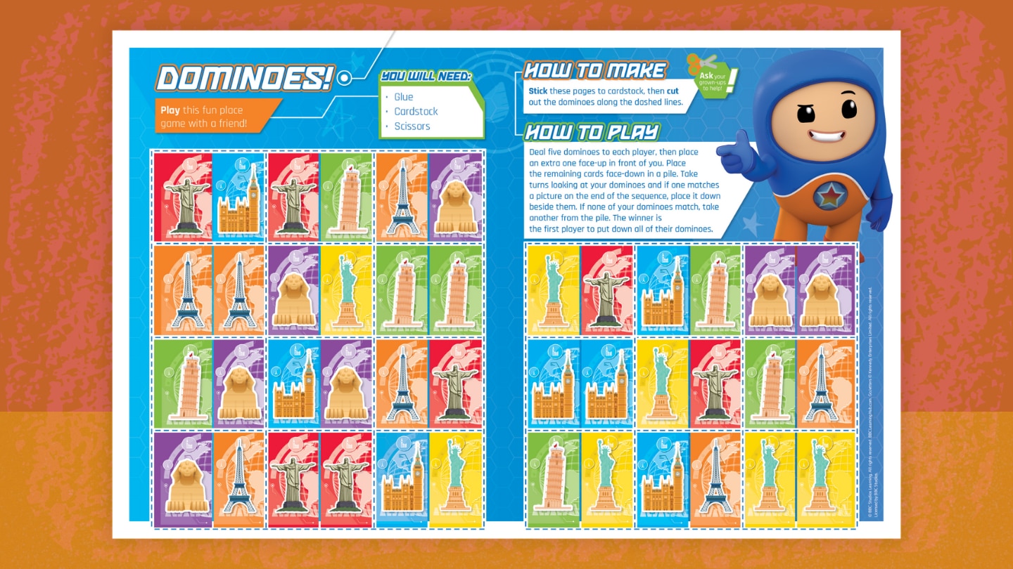
Play this fun Go Jetters dominoes game (featuring famous world landmarks) with a friend! Here's how to play:
- Deal five dominoes to each player, then place an extra one face-up in front of you.
- Place the remaining cards face-down in a pile.
- Take turns looking at your dominoes and if one matches a picture on the end of the sequence, place it down beside them. If none of your dominoes match, take another from the pile.
- The winner is the first player to put down all of their dominoes.
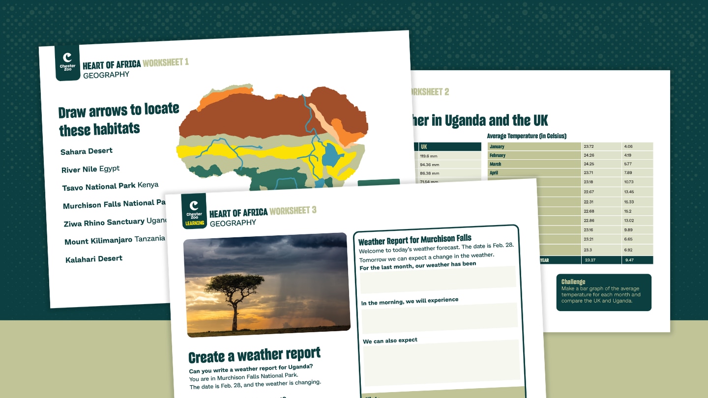
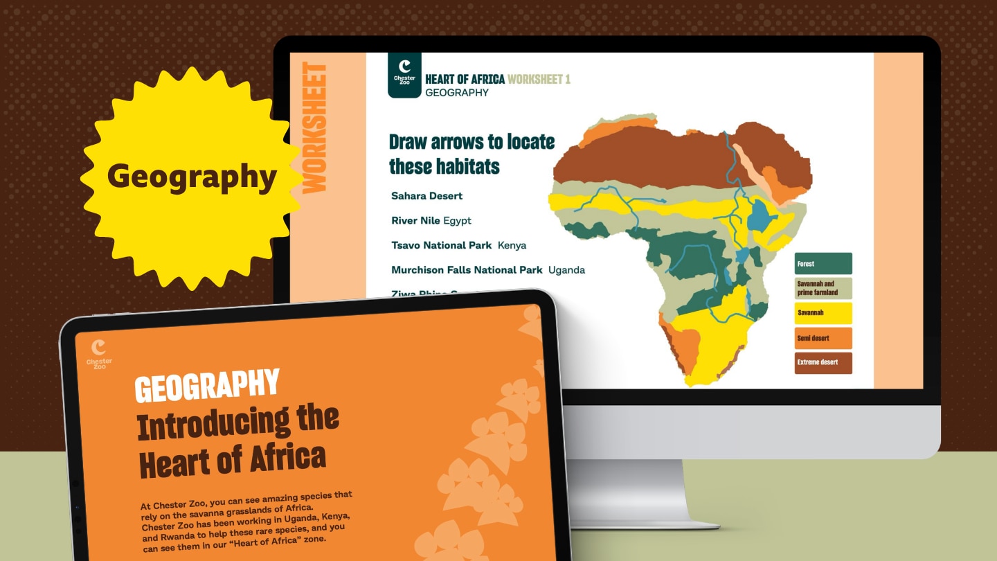
Did you know that Africa is the second largest continent in the world? Or that the equator runs right through the middle? Get an introduction to Africa through its amazing geography. With these worksheets, you'll:
- Identify different types of Afrrican habitats using map of the continent
- Compare the average rainfall and temperature in Uganda and the UK
- Write your own weather report for Murchison Falls in Uganda
These worksheets accompany a Chester Zoo interactive lesson on habitats and weather.

The article "Mauritius: How Sustainable Tourism Is Reviving Its Endangered Wildlife" from BBC's Discover Wildlife explores how luxury tourism is helping the island of Mauritius restore its devastated biodiversity. Through sustainable practices and conservation efforts, the tourism industry is playing a crucial role in supporting rewilding projects, combating invasive species, and contributing to reforestation, with positive results for local wildlife like the Mauritian kestrel and endemic plants.
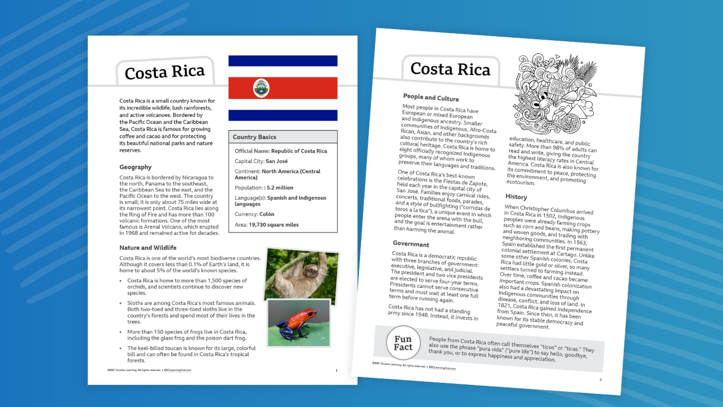
What small country is home to an astonishing variety of plants and animals, hundreds of volcanoes, and tropical forests stretching from coast to coast? Meet Costa Rica, a Central American country known for its incredible biodiversity and commitment to protecting nature.
From sloths and glass frogs to colorful toucans and thousands of orchids, Costa Rica is packed with wildlife. Discover how Indigenous peoples and Spanish colonization shaped the country, learn about its government and culture, and explore traditions such as the Fiestas de Zapote and "pura vida." You’ll also find out why Costa Rica has become a leader in protecting forests, wildlife, and other natural resources.
Teachers and parents, you can use this fact file to:
- Introduce a geography or social studies unit
- Support nonfiction reading practice
- Compare countries and cultures
- Complete map and research activities
- Prepare students for projects or presentations (use our country report template!)
- Pair with videos, articles, or other informational texts (see Related Resources below)
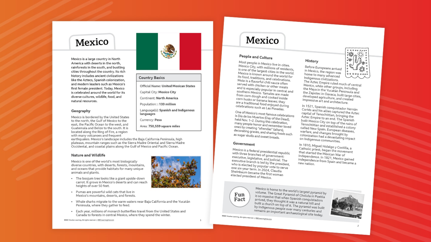
What country is home to ancient pyramids, colorful monarch butterflies, towering volcanoes, and one of the world’s most famous celebrations? Meet Mexico, a country where ancient civilizations, diverse landscapes, and vibrant traditions come together.
From the Aztec and Maya to pumas and whale sharks, Mexico has a remarkable story to tell. Explore the civilizations that shaped the country, discover how Mexico gained independence from Spain, and learn about its food, festivals, languages, government, and cities. You’ll also discover how deserts, mountains, jungles, and coastlines provide habitats for an amazing variety of plants and animals.
Teachers and parents, you can use this fact file to:
- Introduce a geography or social studies unit
- Support nonfiction reading practice
- Compare countries and cultures
- Complete map and research activities
- Prepare students for projects or presentations (use our country report template!)
- Pair with videos, articles, or other informational texts (see Related Resources below)
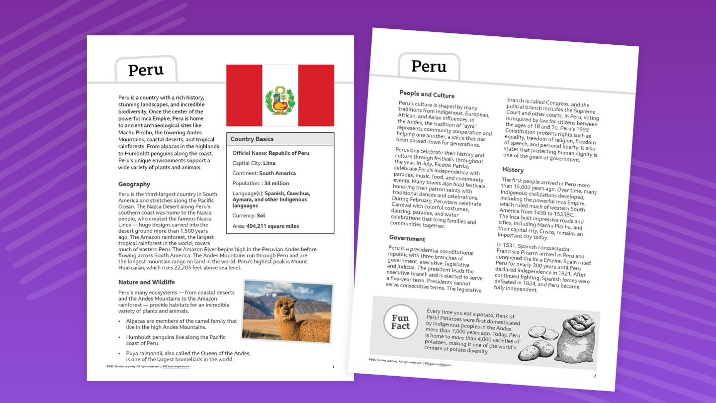
What country is home to the Inca Empire, the Andes Mountains, and more than 3,000 varieties of potatoes? Meet Peru, a country where ancient civilizations and incredible natural landscapes come together.
From Machu Picchu and the ancient city of Cusco to alpacas and the towering Puya Raimondi plant, Peru is full of remarkable discoveries. Explore the civilizations that flourished here, learn how Spanish colonization changed the country, and discover Peru’s languages, traditions, foods, and government. You’ll also travel from the Pacific coast to the high Andes and deep into the Amazon to see how geography shapes life in Peru.
Teachers and parents, you can use this fact file to:
- Introduce a geography or social studies unit
- Support nonfiction reading practice
- Compare countries and cultures
- Complete map and research activities
- Prepare students for projects or presentations (use our country report template!)
- Pair with videos, articles, or other informational texts (see Related Resources below)
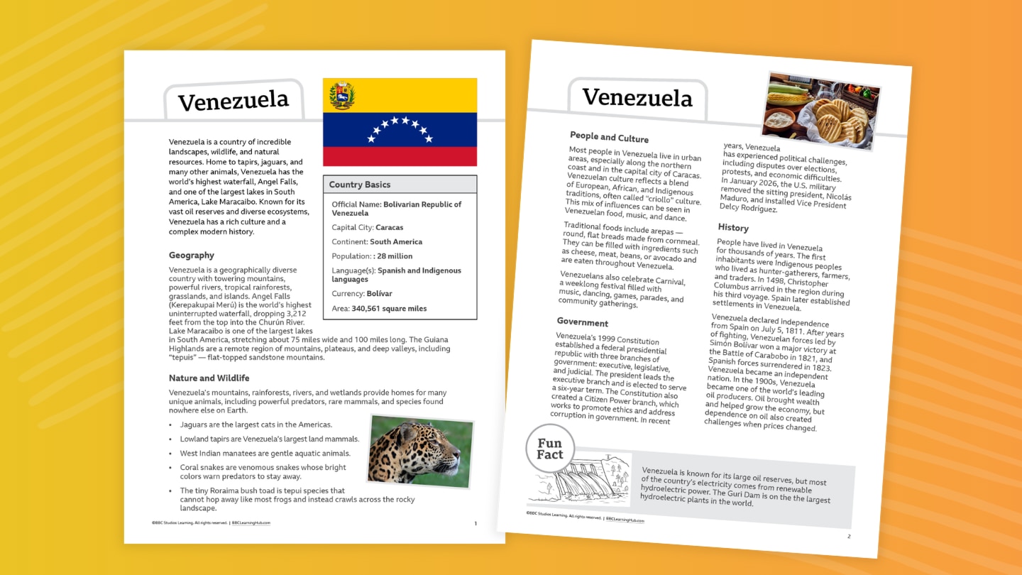
What country is home to the world’s highest waterfall, mysterious flat-topped mountains, and animals found nowhere else? Meet Venezuela, a country of spectacular landscapes and extraordinary biodiversity.
From Angel Falls and the tepuis to jaguars, tapirs, manatees, and the tiny Roraima bush toad, Venezuela is filled with natural wonders. Explore the Indigenous peoples and events that shaped the country’s history, learn about its government and oil-rich economy, and discover the foods, music, festivals, and traditions that make Venezuelan culture unique. You’ll also learn why Venezuela’s isolated tepuis are home to species that have adapted to life high above the surrounding landscape.
Teachers and parents, you can use this fact file to:
- Introduce a geography or social studies unit
- Support nonfiction reading practice
- Compare countries and cultures
- Complete map and research activities
- Prepare students for projects or presentations (use our country report template!)
- Pair with videos, articles, or other informational texts (see Related Resources below)
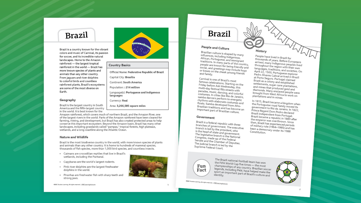
What country is home to the world’s largest tropical rainforest, the greatest biodiversity on Earth, and a culture famous for Carnival and soccer? Meet Brazil, the largest country in South America and a place where natural and cultural wonders stretch across an enormous landscape.
From capybaras and pink river dolphins to the mighty Amazon River and the wetlands of the Pantanal, Brazil is bursting with life. Explore the Indigenous, African, Portuguese, and immigrant influences that shaped Brazilian culture, learn about the country’s history and government, and discover the foods, music, and celebrations that bring people together. You’ll also explore Brazil’s incredible ecosystem.
Teachers and parents, you can use this fact file to:
- Introduce a geography or social studies unit
- Support nonfiction reading practice
- Compare countries and cultures
- Complete map and research activities
- Prepare students for projects or presentations (use our country report template!)
- Pair with videos, articles, or other informational texts (see Related Resources below)
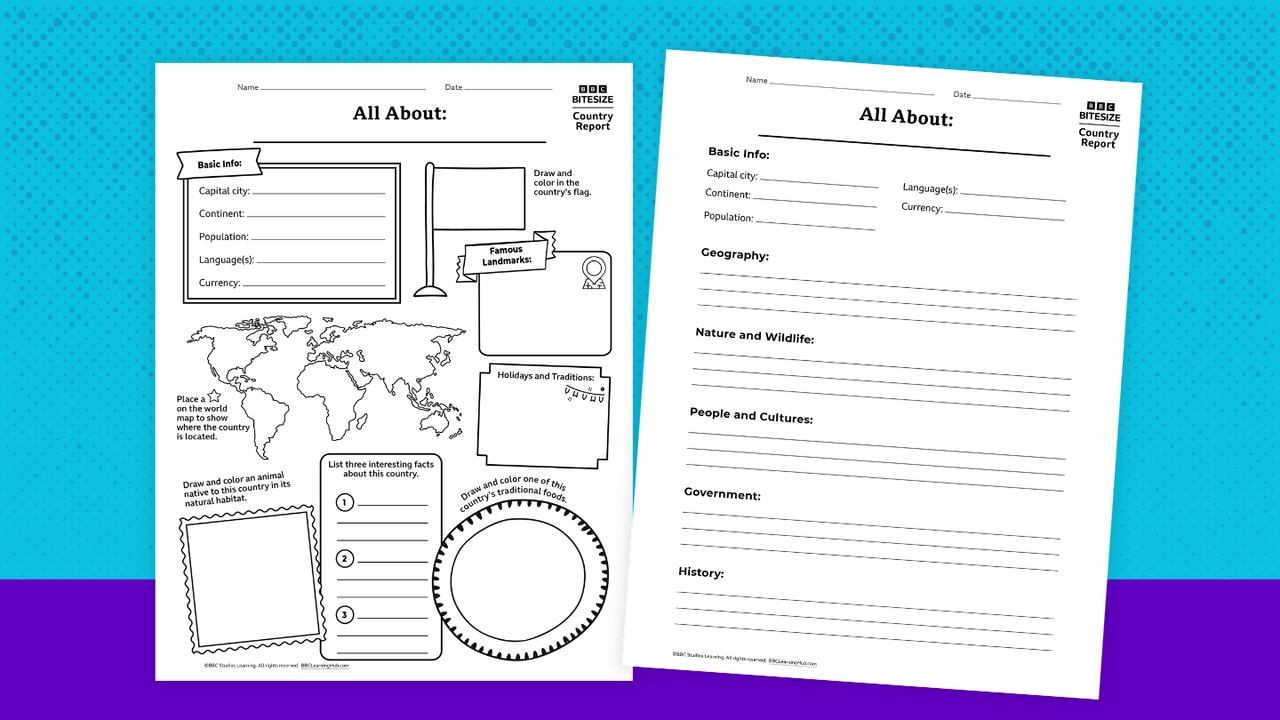
Turn your classroom into a global exploration hub! This country report template invites students in Grades 3–8 to become curious investigators — uncovering what makes each country unique and sharing their discoveries in creative ways.
Designed with flexibility in mind, the resource includes two approachable formats:
- Snapshot Style: A lively, visual option that’s perfect for quick learning or younger students. Learners can sketch, label, and highlight key features — like flags, landmarks, foods, and traditions — while building confidence with short responses.
- Explorer Style: A more in-depth format for students ready to dig deeper. It guides learners through topics such as geography, wildlife, culture, and history, helping them organize ideas and develop clear, informative writing.
Best of all, this template pairs seamlessly with BBC videos — bringing countries to life through real-world sights, sounds, and stories. Students can watch, wonder, and then weave what they’ve learned into their own reports.
Quick Teacher Tips: Use country studies as a springboard into wider learning across subjects:
- Geography: Map skills, climate zones, landforms, and ecosystems
- Language Arts: Informational writing, summarizing, note-taking, and presenting
- History: Key events, timelines, and how the past shapes the present
- Math: Population comparisons, distances, currency conversions
- Arts & Culture: Traditional patterns, music, celebrations, and food
- Current Events: Tie in informational reading and media literacy by exploring what’s happening in that country today in an age-appropriate way.
Discover the Heart of Africa! From sweeping savannas and deserts to forests, mountains, and mighty rivers, Africa is home to an incredible variety of landscapes — and an equally incredible variety of wildlife. Travel across the continent with Chester Zoo to explore some of its most fascinating habitats and discover how geography shapes the animals and people who live there.
Explore the countries and landscapes that make up Africa, identify different habitats, and see what makes each one unique. Then zoom in on the savanna to investigate its climate and discover what life is like in one of the world's most iconic ecosystems.
But the savanna is changing. Learn how shifts in climate are affecting this landscape and the wildlife that depends on it, and discover ways people can help protect these important habitats. Along the way, you'll build your geography skills while seeing Africa — and its wildlife — in a whole new way
Don't miss the geography worksheets that go with this lesson!
Flying over London in a jet? What a view! Can you figure out what time Big Ben is showing? Pretend you’re in the Vroomster soaring above London. Act out what you can see.
Discover Italy’s natural wonders and cultural treasures! In this fun worksheet, you'll:
- Learn what makes a stratovolcano, why Mount Vesuvius is famous, and how Naples shaped pizza history.
- Locate Italy on a map.
- Color a pizza.
- Identify shapes.
Play this fun Go Jetters dominoes game (featuring famous world landmarks) with a friend! Here's how to play:
- Deal five dominoes to each player, then place an extra one face-up in front of you.
- Place the remaining cards face-down in a pile.
- Take turns looking at your dominoes and if one matches a picture on the end of the sequence, place it down beside them. If none of your dominoes match, take another from the pile.
- The winner is the first player to put down all of their dominoes.
Did you know that Africa is the second largest continent in the world? Or that the equator runs right through the middle? Get an introduction to Africa through its amazing geography. With these worksheets, you'll:
- Identify different types of Afrrican habitats using map of the continent
- Compare the average rainfall and temperature in Uganda and the UK
- Write your own weather report for Murchison Falls in Uganda
These worksheets accompany a Chester Zoo interactive lesson on habitats and weather.
The article "Mauritius: How Sustainable Tourism Is Reviving Its Endangered Wildlife" from BBC's Discover Wildlife explores how luxury tourism is helping the island of Mauritius restore its devastated biodiversity. Through sustainable practices and conservation efforts, the tourism industry is playing a crucial role in supporting rewilding projects, combating invasive species, and contributing to reforestation, with positive results for local wildlife like the Mauritian kestrel and endemic plants.
What small country is home to an astonishing variety of plants and animals, hundreds of volcanoes, and tropical forests stretching from coast to coast? Meet Costa Rica, a Central American country known for its incredible biodiversity and commitment to protecting nature.
From sloths and glass frogs to colorful toucans and thousands of orchids, Costa Rica is packed with wildlife. Discover how Indigenous peoples and Spanish colonization shaped the country, learn about its government and culture, and explore traditions such as the Fiestas de Zapote and "pura vida." You’ll also find out why Costa Rica has become a leader in protecting forests, wildlife, and other natural resources.
Teachers and parents, you can use this fact file to:
- Introduce a geography or social studies unit
- Support nonfiction reading practice
- Compare countries and cultures
- Complete map and research activities
- Prepare students for projects or presentations (use our country report template!)
- Pair with videos, articles, or other informational texts (see Related Resources below)
What country is home to ancient pyramids, colorful monarch butterflies, towering volcanoes, and one of the world’s most famous celebrations? Meet Mexico, a country where ancient civilizations, diverse landscapes, and vibrant traditions come together.
From the Aztec and Maya to pumas and whale sharks, Mexico has a remarkable story to tell. Explore the civilizations that shaped the country, discover how Mexico gained independence from Spain, and learn about its food, festivals, languages, government, and cities. You’ll also discover how deserts, mountains, jungles, and coastlines provide habitats for an amazing variety of plants and animals.
Teachers and parents, you can use this fact file to:
- Introduce a geography or social studies unit
- Support nonfiction reading practice
- Compare countries and cultures
- Complete map and research activities
- Prepare students for projects or presentations (use our country report template!)
- Pair with videos, articles, or other informational texts (see Related Resources below)
What country is home to the Inca Empire, the Andes Mountains, and more than 3,000 varieties of potatoes? Meet Peru, a country where ancient civilizations and incredible natural landscapes come together.
From Machu Picchu and the ancient city of Cusco to alpacas and the towering Puya Raimondi plant, Peru is full of remarkable discoveries. Explore the civilizations that flourished here, learn how Spanish colonization changed the country, and discover Peru’s languages, traditions, foods, and government. You’ll also travel from the Pacific coast to the high Andes and deep into the Amazon to see how geography shapes life in Peru.
Teachers and parents, you can use this fact file to:
- Introduce a geography or social studies unit
- Support nonfiction reading practice
- Compare countries and cultures
- Complete map and research activities
- Prepare students for projects or presentations (use our country report template!)
- Pair with videos, articles, or other informational texts (see Related Resources below)
What country is home to the world’s highest waterfall, mysterious flat-topped mountains, and animals found nowhere else? Meet Venezuela, a country of spectacular landscapes and extraordinary biodiversity.
From Angel Falls and the tepuis to jaguars, tapirs, manatees, and the tiny Roraima bush toad, Venezuela is filled with natural wonders. Explore the Indigenous peoples and events that shaped the country’s history, learn about its government and oil-rich economy, and discover the foods, music, festivals, and traditions that make Venezuelan culture unique. You’ll also learn why Venezuela’s isolated tepuis are home to species that have adapted to life high above the surrounding landscape.
Teachers and parents, you can use this fact file to:
- Introduce a geography or social studies unit
- Support nonfiction reading practice
- Compare countries and cultures
- Complete map and research activities
- Prepare students for projects or presentations (use our country report template!)
- Pair with videos, articles, or other informational texts (see Related Resources below)
What country is home to the world’s largest tropical rainforest, the greatest biodiversity on Earth, and a culture famous for Carnival and soccer? Meet Brazil, the largest country in South America and a place where natural and cultural wonders stretch across an enormous landscape.
From capybaras and pink river dolphins to the mighty Amazon River and the wetlands of the Pantanal, Brazil is bursting with life. Explore the Indigenous, African, Portuguese, and immigrant influences that shaped Brazilian culture, learn about the country’s history and government, and discover the foods, music, and celebrations that bring people together. You’ll also explore Brazil’s incredible ecosystem.
Teachers and parents, you can use this fact file to:
- Introduce a geography or social studies unit
- Support nonfiction reading practice
- Compare countries and cultures
- Complete map and research activities
- Prepare students for projects or presentations (use our country report template!)
- Pair with videos, articles, or other informational texts (see Related Resources below)
Turn your classroom into a global exploration hub! This country report template invites students in Grades 3–8 to become curious investigators — uncovering what makes each country unique and sharing their discoveries in creative ways.
Designed with flexibility in mind, the resource includes two approachable formats:
- Snapshot Style: A lively, visual option that’s perfect for quick learning or younger students. Learners can sketch, label, and highlight key features — like flags, landmarks, foods, and traditions — while building confidence with short responses.
- Explorer Style: A more in-depth format for students ready to dig deeper. It guides learners through topics such as geography, wildlife, culture, and history, helping them organize ideas and develop clear, informative writing.
Best of all, this template pairs seamlessly with BBC videos — bringing countries to life through real-world sights, sounds, and stories. Students can watch, wonder, and then weave what they’ve learned into their own reports.
Quick Teacher Tips: Use country studies as a springboard into wider learning across subjects:
- Geography: Map skills, climate zones, landforms, and ecosystems
- Language Arts: Informational writing, summarizing, note-taking, and presenting
- History: Key events, timelines, and how the past shapes the present
- Math: Population comparisons, distances, currency conversions
- Arts & Culture: Traditional patterns, music, celebrations, and food
- Current Events: Tie in informational reading and media literacy by exploring what’s happening in that country today in an age-appropriate way.