
The article "Satellites in Orbit Can Now Be Hacked: Why That's Really Bad!" from BBC's Science Focus explains the growing concern of satellite cybersecurity and hacking. The article discusses potential hacking methods, the consequences of such attacks, and the current lack of global regulations to prevent them.
Forests store huge amounts of carbon, likely hundreds of billions of tons. One metric ton is about 2,200 pounds, so hundreds of billions of tons is... let's just say it's a lot. Because trees pull carbon dioxide out of the air and lock it away, forests play a major role in controlling Earth's climate.
To figure out how much carbon a forest holds, scientists can measure individual trees, like how wide the trunk is and how tall the tree grows. But nobody can take a tape measure to millions of square miles of forest, and "a whole bunch" isn't a scientific measurement.
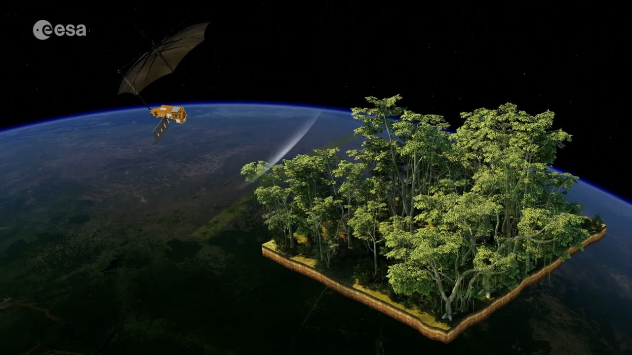
That's where new technology comes in. In 2025, the European Space Agency, which runs space missions for a group of European countries, launched a satellite called Biomass. It uses radar with extra-long wavelengths. The longer the wavelength, the more easily radar can pass through leaves and small branches and pick up bigger things, like trunks and large branches, which hold most of a tree's carbon.
Most earlier satellites, like many launched by NASA, the U.S. space agency, are optical. They work like cameras, capturing sunlight reflected off the treetops. That's useful for seeing where forests are, but it mostly shows the top layer. Radar can reveal what's underneath. It can help scientists estimate how much wood a forest holds, spot deforestation, and study flooded forests that are hard to reach. Scientists then check the satellite data against measurements taken from planes and on the ground.
Another tool is LiDAR, short for Light Detection and Ranging. It sends out pulses of laser light and measures how long they take to bounce back, building detailed 3D maps of forests. Some are precise enough to show individual twigs and leaves. LiDAR isn't new, but it produces enormous amounts of data. Artificial intelligence is now making that data much faster to process, turning LiDAR into a more practical tool for studying forests.
The article "Satellites in Orbit Can Now Be Hacked: Why That's Really Bad!" from BBC's Science Focus explains the growing concern of satellite cybersecurity and hacking. The article discusses potential hacking methods, the consequences of such attacks, and the current lack of global regulations to prevent them.
Forests store huge amounts of carbon, likely hundreds of billions of tons. One metric ton is about 2,200 pounds, so hundreds of billions of tons is... let's just say it's a lot. Because trees pull carbon dioxide out of the air and lock it away, forests play a major role in controlling Earth's climate.
To figure out how much carbon a forest holds, scientists can measure individual trees, like how wide the trunk is and how tall the tree grows. But nobody can take a tape measure to millions of square miles of forest, and "a whole bunch" isn't a scientific measurement.
That's where new technology comes in. In 2025, the European Space Agency, which runs space missions for a group of European countries, launched a satellite called Biomass. It uses radar with extra-long wavelengths. The longer the wavelength, the more easily radar can pass through leaves and small branches and pick up bigger things, like trunks and large branches, which hold most of a tree's carbon.
Most earlier satellites, like many launched by NASA, the U.S. space agency, are optical. They work like cameras, capturing sunlight reflected off the treetops. That's useful for seeing where forests are, but it mostly shows the top layer. Radar can reveal what's underneath. It can help scientists estimate how much wood a forest holds, spot deforestation, and study flooded forests that are hard to reach. Scientists then check the satellite data against measurements taken from planes and on the ground.
Another tool is LiDAR, short for Light Detection and Ranging. It sends out pulses of laser light and measures how long they take to bounce back, building detailed 3D maps of forests. Some are precise enough to show individual twigs and leaves. LiDAR isn't new, but it produces enormous amounts of data. Artificial intelligence is now making that data much faster to process, turning LiDAR into a more practical tool for studying forests.